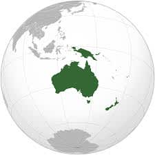
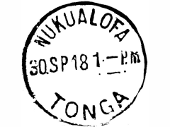
CountryAustralia
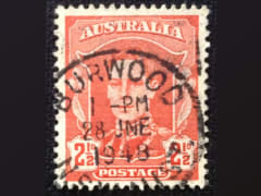
Australia
Town
Burwod
Cacellation Date
28 Jun 1948
Town Info
Burwood is a suburb in the Inner West of Sydney, in the state of New South Wales, Australia. It is 10 kilometres west of the Sydney central business district and is the administrative centre for the local government area of Burwood Council. Burwood Heights is a separate suburb to the south.
Location
Black Page 32
Australia
Town
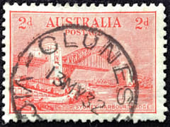
Clunes
Cacellation Date
13 May 1932
Town Info
Clunes is a town in Victoria, Australia, 36 kilometres north of Ballarat, in the Shire of Hepburn. At the 2016 census it had a population of 1,728.
Location
Black Page 32
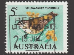
Australia
Town
Perth
Cacellation Date
15 Jul 1966
Town Info
Perth, capital of Western Australia, sits where the Swan River meets the southwest coast. Sandy beaches line its suburbs, and the huge, riverside Kings Park and Botanic Garden on Mount Eliza offer sweeping views of the city. The Perth Cultural Centre houses the state ballet and opera companies, and occupies its own central precinct, including a theatre, library and the Art Gallery of Western Australia.
Location
Black Page 32
Australia
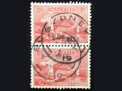
Town
Sydney
Cacellation Date
1932
Town Info
Sydney, capital of New South Wales and one of Australia's largest cities, is best known for its harbourfront Sydney Opera House, with a distinctive sail-like design. Massive Darling Harbour and the smaller Circular Quay port are hubs of waterside life, with the arched Harbour Bridge and esteemed Royal Botanic Garden nearby. Sydney Tower’s outdoor platform, the Skywalk, offers 360-degree views of the city and suburbs.
Location
Collection
CountryTasmania
Tasmania
Town
Hobart
Cacellation Date
19 Mar 1904
Town Info
Hobart, capital of Australia's island state of Tasmania, sits on the River Derwent. At its fashionable Salamanca Place, old sandstone warehouses host galleries and cafes. Nearby is Battery Point, a historic district with narrow lanes and colonial-era cottages. The city's backdrop is 1,270m-high Mount Wellington, with sweeping views, plus hiking and cycling trails.
Location
Collection

Tasmania
Town
Hobart
Cacellation Date
Town Info
Hobart, capital of Australia's island state of Tasmania, sits on the River Derwent. At its fashionable Salamanca Place, old sandstone warehouses host galleries and cafes. Nearby is Battery Point, a historic district with narrow lanes and colonial-era cottages. The city's backdrop is 1,270m-high Mount Wellington, with sweeping views, plus hiking and cycling trails.
Location
Black Page 32

Tasmania
Town
Hobart
Cacellation Date
25 Jan 1901
Town Info
Hobart, capital of Australia's island state of Tasmania, sits on the River Derwent. At its fashionable Salamanca Place, old sandstone warehouses host galleries and cafes. Nearby is Battery Point, a historic district with narrow lanes and colonial-era cottages. The city's backdrop is 1,270m-high Mount Wellington, with sweeping views, plus hiking and cycling trails.
Location
Black Page 32

Tasmania
Town
PO No 5
Cacellation Date
5 Jun 1907
Town Info
Location
Collection

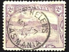
Tasmania
Town
St Helen's
Cacellation Date
17 May 1907
Town Info
St Helens is the largest town on the north-east coast of Tasmania, Australia, on Georges Bay. It is known as the game fishing capital of Tasmania and is also renowned for its oysters. It is located on the Tasman Highway, about 160 km east of Tasmania's second largest city, Launceston.
Location
Collection
CountryWestern Australia
Western Australia
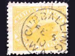
Town
Cubballing
Cacellation Date
Town Info
Cuballing is a town located in the Wheatbelt region of Western Australia, on Great Southern Highway, between Pingelly and Narrogin. At the 2016 census, Cuballing had a population of 458
Location
Black Page 32
Western Australia
Town
Cacellation Date
Town Info
Location
